Blog · Drone · 5 min read
Real estate drone photography: when it’s worth it
Real estate drone photography shows the plot, surroundings and scale you can’t capture from the ground. When aerial shots pay off and what you get in 24 h.
 Bohuš Zeman
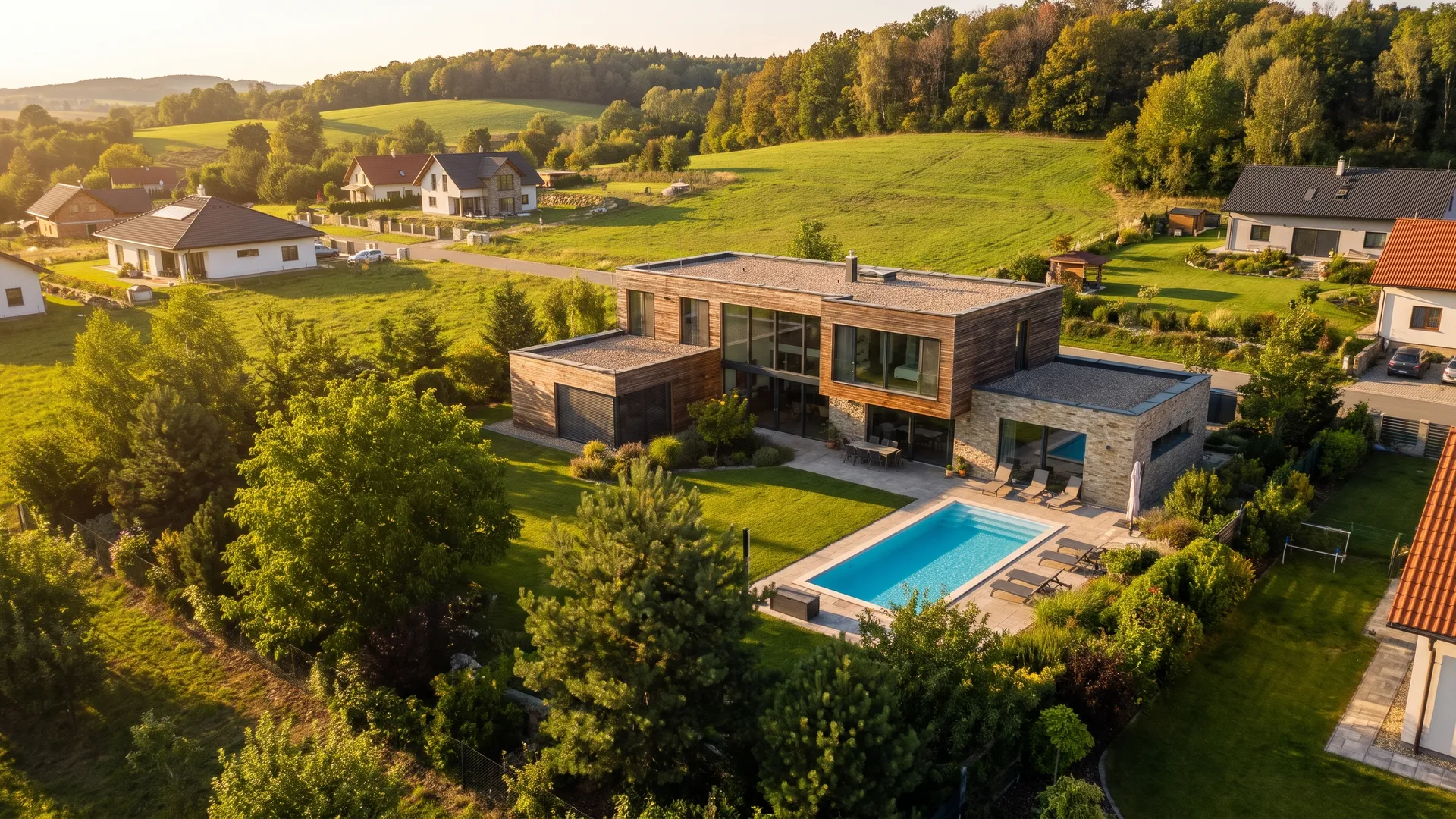
Drone photography pays off wherever a property’s value also depends on what is around it: the size and shape of the plot, the garden, the view, the access or an entire site. Aerial shots show the context a ground-level photo misses, and buyers understand the location before they even come to a viewing.
Below you will find which properties benefit most from a drone, when you do not need one, what you get from us and how an aerial shoot works.
What aerial shots show that ground photos cannot
- The real size and shape of the plot, including the boundaries with the neighbours.
- Where the house sits on the plot and which way the garden or terrace faces.
- The surroundings: greenery, water, views and the neighbouring buildings.
- Access: the driveway and how the property connects to the area around it.
- The scale of a site or project as a whole, not just a single building.
- Construction progress: the same plot during the build and after completion.
From one aerial shot, buyers piece together in seconds what they would otherwise work out from a map, a description and several photos. That is why a listing with a good shot from above feels more complete and more trustworthy.
When real estate drone photography is worth it
A drone is not a must for every listing. It makes the biggest difference for these types of property:
Family houses with a garden
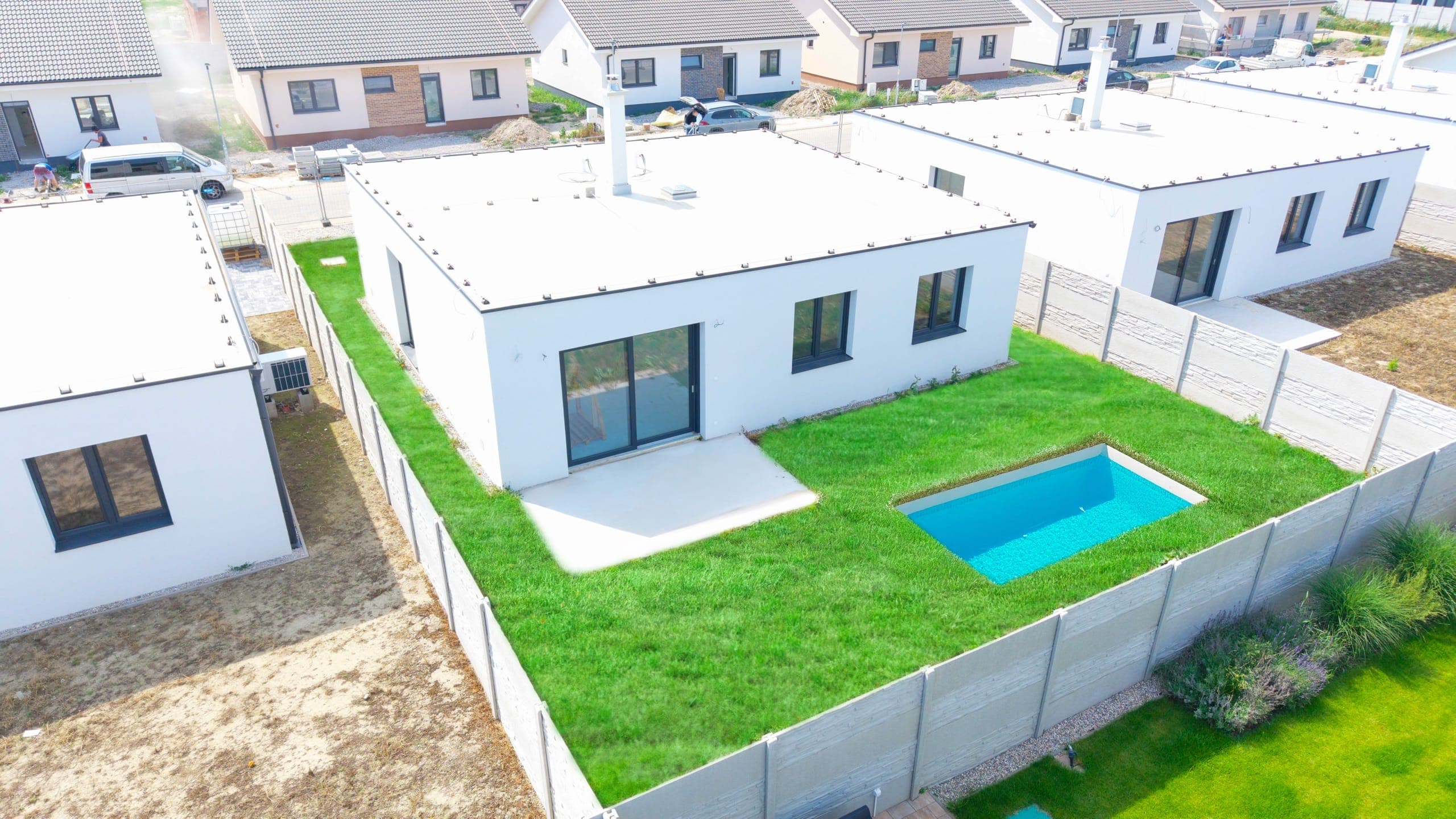
From the ground you capture the facade and a corner of the garden. From above you show the whole plot, the pool, the terrace, the garage and how the house fits into the street. For houses with a large plot or attractive surroundings, the aerial shot is often the strongest cover photo.
Building plots
With a plot, there is often nothing to photograph from the ground: grass, a fence and sky. A drone shows the shape and size of the parcel, the access road, the neighbourhood and the landscape around it, which is exactly what a plot buyer cares about most. For a plot on the market, the aerial shot is often the only photo that genuinely helps them decide.
Development projects and new builds
With a development, you are selling the location and the whole scheme, not a single flat. Aerial shots show where the project stands, what is nearby and how big it is. During construction they double as documentation: the same plot during the build and after completion shows progress better than any text.
Sites, resorts and commercial properties
A golf course, a hotel or an industrial site cannot be shown from the ground. For Grafobal Golf Resort we shot the entire grounds during the day and at sunset, and delivered 64 edited aerial photos, a 0:58 film and 3 reels for social media, all within 3 days.
They handled tailored drone photography of the whole resort for us, from the buildings to the sunset. The quality of the shots is top-notch. – Grafobal Group Golf Resort
When you do not need a drone
For a flat in the middle of an apartment block, where the surroundings are not a selling point, a drone adds little. Interior photos are what count there. But if the flat has a view, is close to a park or water, or belongs to a new development, even one aerial shot can lift the listing.
What you get: drone photos and video
- Aerial photos blended from three exposures (−1 / 0 / +1 EV) with a fast shutter speed, so they are sharp even in motion.
- 4K video with slow aerial panoramas from a DJI Air 3S for premium properties.
- Fast FPV fly-throughs of a site or building that hold attention on social media.
- Professional editing: colour, cut and a music track.
- Delivery within 24 hours via a download link.
- Full copyright and a backup of the RAW files, which we provide on request.
Drone photos start at €120 and drone photos plus video at €220, excl. VAT. If we are already shooting from the ground, we can add 5–8 drone photos for €49.
You can use aerial shots wherever you present the property: as the cover photo of a listing, on the project website, in videos and reels on social media and in printed materials. For development projects they also work in reports for investors and banks, where construction progress is clear at a glance from above. Rights for marketing use are included.
How a drone shoot works
- Enquiry and price: on the day you enquire, you get a quote based on the location and the scope of the flight.
- Permits and airspace: we check the airspace and arrange the permits. We fly with A1/A3 and A2 licences and authorisation for commercial operations, so there is nothing for you to sort out.
- The flight: a DJI Air 3S for photos and panoramas, an FPV drone for dynamic fly-throughs.
- Delivery within 24 hours: you receive the aerial photos and 4K video via a download link.
We watch the forecast in advance. If conditions are not right, we move the date free of charge to the next suitable day. We never deliver bad footage.
Drone and interior photos in one visit
The best results come from combining both: aerial shots show the plot and the location, ground photos show the interior and the details. We shoot everything in a single visit, so there is no need to find two dates, and 5–8 drone photos can be added to a ground shoot for €49. For developers we also provide regular construction documentation, weekly, fortnightly or monthly, with photos, video and drone footage from every visit.
How much does real estate drone photography cost?
Drone photos start at €120 and drone photos plus video at €220, excl. VAT. As an add-on to a ground photo shoot, 5–8 drone photos cost €49.
When will I get the aerial footage?
We deliver the aerial photos and 4K video within 24 hours via a download link.
Do I need to sort out flight permits?
No. We fly with A1/A3 and A2 licences and authorisation for commercial operations, and we handle airspace coordination and permits for you.
What if the weather doesn’t cooperate?
We watch the forecast in advance. If conditions are not right, we move the date free of charge to the next suitable day.
What is the difference between a standard drone and an FPV drone?
A standard drone (DJI Air 3S) takes stable photos and slow panoramas. An FPV drone flies fast and close, ideal for dynamic fly-throughs of a site or building.